 Skip to content

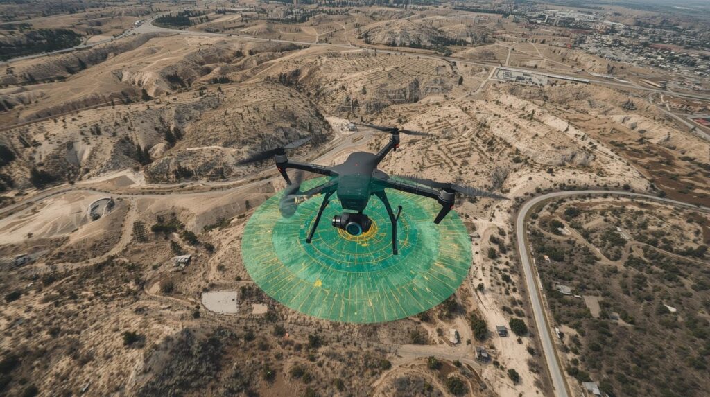
A LiDAR drone survey uses airborne laser pulses from a LiDAR sensor mounted on a drone to capture high-resolution spatial data of the ground surface, even through dense vegetation. By generating dense point clouds and precise topographic mapping, LiDAR drone surveying delivers faster, safer, and more accurate terrain models than traditional methods, especially in complex environments such as forests, industrial facilities, corridors, and hard-to-access areas.
LiDAR Drone Survey: A Technical Guide for Modern Infrastructure Projects
LiDAR drone survey has become one of the most reliable methods for capturing detailed spatial data across large, complex, or hazardous terrain. As land surveyors and civil engineers face tighter project timelines, stricter environmental requirements, and increasing demand for high-resolution data, LiDAR drone technology provides a measurable improvement in accuracy, operational efficiency, and safety.
Drone-based LiDAR systems are no longer experimental. Today, lidar drones equipped with high-performance lidar sensors and modular payload options are capable of producing survey-grade results that rival or surpass traditional ground-based methods.
How LiDAR Drone Surveying Works
A LiDAR drone survey relies on light detection and ranging. A LiDAR sensor emits rapid laser pulses toward the ground. These laser beams reflect back to the sensor, allowing the system to calculate precise distance measurements. When combined with GNSS and IMU data, the result is a detailed, georeferenced point cloud.
Key components of a LiDAR drone system
- LiDAR sensor – Generates high-frequency laser pulses and detects returns.
- Aerial drone platform – Multirotor units like the DJI Matrice 350 RTK or fixed wing drone systems that offer longer flight time and ability to carry heavy payloads.
- Modular payload mount – Allows different LiDAR payloads or high-resolution cameras to be attached.
- Advanced software – Processes the lidar data, aligns point clouds, and produces topographic mapping outputs.
Why LiDAR performs well in challenging environments
Unlike photogrammetry, which fails under canopy, LiDAR can penetrate:
- Dense vegetation
- Thick forests
- Areas with heavy canopy density
Multiple laser returns allow the system to distinguish between foliage, mid-story vegetation, and actual ground surface.
What LiDAR Drone Surveying Captures
LiDAR drones work by rapidly gathering millions of data points across the landscape. This provides:
1. High-resolution data
High-performance LiDAR sensors create dense point clouds, enabling accurate modeling of terrain, utilities, and built structures.
2. Precise mapping under vegetation
Aerial LiDAR can detect ground elevation even in:
- Dense vegetation
- Thick forest cover
- Areas with limited visibility
This makes drone lidar surveying ideal for environmental monitoring, forest health analysis, and topographic surveys.
3. Safe access to difficult or dangerous areas
LiDAR-equipped drones eliminate the need for survey crews to enter:
- Steep slopes
- Floodplains
- Industrial facilities
- Remote corridors
Drones gather data from above, improving safety and reducing field exposure.
4. Consistency and repeatability
Aerial data collection is standardized, allowing surveyors to monitor:
- Earthwork progress
- Corridor mapping changes
- Construction progress tracking
Applications of LiDAR Drone Technology
LiDAR surveying is now used across infrastructure, environmental, and industrial sectors. The most common applications include:
Topographic Mapping and Terrain Modeling
Drone-based LiDAR produces accurate DEMs and DTMs that capture:
- Ground surface elevation
- Breaklines
- Slopes and drainage paths
This is essential for roadway planning, site design, grading analysis, and various civil engineering workflows. Many engineering teams pair LiDAR terrain models with 3D laser scanning to capture detailed as-built conditions during construction and renovation projects.
Corridor Mapping
Aerial LiDAR is widely used for:
- Transmission lines
- Rail corridors
- Pipeline routes
- Highway expansions
LiDAR drones provide continuous, high-quality data while maintaining reliable operation in various challenging environments.
Environmental Monitoring
LiDAR mapping enables:
- Forest health analysis
- Vegetation density studies
- Floodplain assessment
- Habitat modeling
Canopy penetration provides detailed insights that cannot be gathered with traditional methods.
Precision Agriculture
Farmers and agronomists use LiDAR systems for:
- Field drainage analysis
- Crop density evaluation
- Terrain optimization
High-accuracy spatial data increases operational efficiency and resource planning.
Construction, Mining, and Industrial Facilities
LiDAR drones assist in:
- Stockpile measurement
- Volumetric analysis
- As-built documentation
- Safety audits
- Change detection across complex environments
Also read: What Is a Laser Profilometer?
Why LiDAR Drones Outperform Traditional Methods
Traditional land surveying often requires:
- Long field hours
- Manual traverses
- Extensive ground control points
- Crews navigating difficult terrain
LiDAR drone technology reduces these constraints by capturing high-quality data in a fraction of the time.
Operational Efficiency
Drones equipped with LiDAR can complete large areas in one or two flights, significantly lowering labor hours.
Higher Accuracy in Vegetated Terrain
LiDAR mapping is the most reliable method for detecting ground elevation under vegetation, outperforming:
- Photogrammetry
- GNSS-only surveys
- Total station traverses
Reduced Costs Over Time
While LiDAR drone cost may be higher upfront, project-level savings come from:
- Less time in the field
- Fewer revisits
- Faster data processing
- Lower risk exposure
Flexibility in the Field
Most lidar drones today are designed with modular payload systems, allowing land surveyors to switch between:
- High-performance LiDAR sensors
- RGB mapping cameras
- Thermal imaging systems
Top Drone Platforms for LiDAR Surveying
1. DJI Matrice 350 RTK
One of the most widely used top lidar drones, known for:
- Long flight time
- Ability to carry heavy payloads
- Stable RTK positioning
- Reliable operation in challenging environments
2. Fixed Wing Drone Platforms
Ideal for long-range corridor mapping, offering:
- Higher endurance
- Efficient coverage of large terrain
- Greater distances under visual line rules
Choosing the Right LiDAR Drone
Key factors include:
- Required accuracy and point density
- Size of survey area
- Canopy density
- Need for heavy LiDAR payloads
- Integration with advanced software
- Terrain complexity
The Data Pipeline: From Capture to Deliverables
High-quality results rely on both data collection and processing workflows.
1. Data Capture
Surveyors plan flight paths, ensuring proper altitude, overlap, and ground speed to gather data effectively. Ground control points may be used to further refine accuracy.
2. Processing Data
Data processing involves:
- Trajectory correction
- Point cloud classification
- Noise removal
- Ground surface extraction
- Feature segmentation
The final point cloud then feeds into:
- Topographic surveys
- Engineering design models
- 3D visualizations
- Environmental reports
3. Delivering Precise Data
Drone data must meet accuracy standards required for:
- Civil design
- Environmental monitoring
- Construction verification
When executed correctly, LiDAR drone surveying provides detailed, high-resolution data that can be relied upon for decision-making across every project phase.
Challenges and Limitations
While lidar drone technology is powerful, surveyors must consider:
- Battery-limited flight time
- Weather impacts on aerial data collection
- Need for line of sight compliance
- Expertise required to operate lidar systems
- Variation in lidar drone cost and performance
Still, for most complex environments, LiDAR delivers superior performance compared to traditional methods.
LiDAR in the Next Generation of Civil and Infrastructure Projects
LiDAR drone surveying has become a critical part of construction data acquisition, not because it’s new, but because it consistently produces the level of accuracy modern engineering demands. On complex sites where grading tolerances are tight, vegetation masks the ground surface, or access is limited, drone-based LiDAR captures structured spatial data that integrates directly into design, modeling, and verification workflows.
What makes it indispensable is not just the point density or the speed of collection, it’s the way LiDAR reveals conditions that traditional methods routinely miss. Terrain irregularities, hidden contours beneath canopy, drainage pathways, erosion risks, and real-time earthwork changes become measurable and quantifiable.
For contractors and civil engineers managing tight schedules and high-risk decisions, LiDAR is no longer a specialty deliverable. It is a fundamental part of building with precision in environments that don’t forgive guesswork.