 Skip to content

Ground Penetrating Radar (GPR) is a non-destructive geophysical method that uses high-frequency radar pulses to detect subsurface objects, voids, utilities, and structural anomalies. A GPR system transmits electromagnetic waves into the ground; when those waves encounter materials with different dielectric properties, they reflect back to a receiver antenna. The reflected signal is processed into GPR data profiles that reveal depth, location, and shape of subsurface features. Penetration depth and resolution depend on antenna frequency, soil conditions, electrical conductivity, and dielectric constants. GPR is widely used in civil engineering for concrete inspection, utility locating, pavement condition assessment, unmarked grave detection, environmental studies, and ice-thickness measurement.While GPR focuses on subsurface investigation, LiDAR drone surveys are commonly used to capture high-resolution surface topography and site conditions, providing essential context for civil engineering planning and design.
What is Ground Penetrating Radar (GPR)
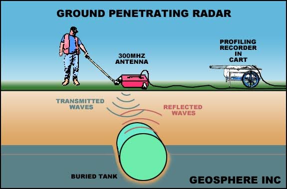
GPR ground penetrating radar is a field-proven method for imaging subsurface structures using radar pulses and electromagnetic radiation. A GPR system works by sending radar waves (typically 10 MHz to 2.6 GHz) into the ground. When these radar waves hit a boundary between materials with different dielectric permittivity or electrical properties, part of the radar energy is returned as a reflected signal.
Key principles:
- Penetration depth depends primarily on soil electrical conductivity, moisture content, and antenna frequency.
- Higher frequencies (e.g., 1–2 GHz) provide higher resolution but shallow depth.
- Lower frequencies penetrate deeper but reduce the ability to detect smaller objects.
This ground-penetrating radar theory makes the GPR method effective for imaging subsurface objects, subsurface features, underground utilities, buried objects, and subsurface voids without excavation. Because GPR is non-destructive, it is widely used in civil engineering, construction, archaeology, military landmine detection, and geophysical research.
GPR Method and Technology
The core of the GPR method is simple:
- A GPR antenna transmits radar pulses into the ground.
- Electromagnetic waves interact with subsurface materials.
- Reflected signals return to the receiver antenna.
- Data processing software converts reflections into 2D or 3D images.
How GPR Works
- Radar signal: Sent from the transmitting antenna into subsurface materials.
- Radar waves: Travel through soil, concrete, or ice.
- Reflected electromagnetic energy: Returned when a contrast in dielectric constants exists.
- Data interpretation: Converts travel time into depth measurements.
GPR technology is effective for detecting subsurface anomalies, subsurface structures, and material changes. Penetrating radar theory explains that the strength and clarity of GPR signal reflections depend on contrasts in relative dielectric permittivity.
Example: Landmine Detection
- Typical central frequency: 1–2 GHz
- Detectable size: 8–10 cm diameter mines
- Smaller objects require higher frequencies but lose depth penetration
GPR Systems and Equipment
A modern GPR unit contains:
- Waveform generator (creates radar pulses)
- Transmitting/receiving GPR antenna
- Data storage/display module
- Signal processor
GPR equipment varies mainly by antenna frequency, which sets depth capabilities and lateral resolution.
For example:
- High-frequency antennas (1–2.6 GHz): excellent for concrete structures, rebar mapping, small targets
- Low frequency antennas (10–200 MHz): ideal for deep ground surveys and detecting large subsurface features
Civil engineers routinely use GPR scans to locate rebar, post-tension cables, anchors, voids, and subsurface structures. Improvements in data processing and geophysical methods continue to expand applications in engineering geophysics and nondestructive evaluation.
Data Collection and Data Processing
GPR data is digital, making data processing essential for interpreting subsurface objects and material properties.
Common Data Outputs
- Vertical profiles (2D radargrams): Cross-sections along a survey line
- Horizontal slices: Amplitude maps at specific depths
- 3D reconstructions: Stacked slices for full subsurface modeling
Processing Tools
Data processing software performs:
- Signal filtering
- Gain adjustments
- Background removal
- Migration (correcting subsurface geometry)
- 3D visualization
These steps improve data quality and enable accurate identification of subsurface anomalies, subsurface voids, and buried objects.
Applications of Ground Penetrating Radar
1. Civil & Structural Engineering
GPR is widely used to evaluate:
- Concrete structures: locating rebar, tendons, anchors
- Bridge decks: detecting delaminations, moisture, and voids
- Pavements: layer analysis, thickness measurement, subsurface defects
- Post-tensioned slabs: mapping tendon profiles
- Composite materials: identifying anomalies or debonding
GPR can detect defects up to several hundred millimeters deep, with typical resolutions of 10–20 mm depending on antenna frequency.In complex construction environments, GPR data is often combined with 3D laser scanning to create accurate as-built models that capture both visible structural elements and hidden subsurface features, supporting clash detection, retrofit planning, and construction verification.
2. Utility Locating and Ground Surveys
GPR surveys can locate:
- Underground utilities
- Unmarked graves
- Septic tanks
- Subsurface voids
- Unknown buried structures
Unlike metal detectors, GPR identifies non-metallic objects based on dielectric properties.
3. Archaeology
GPR is a preferred method for imaging buried walls, foundations, and smaller objects without disturbing the ground surface.
4. Environmental and Hydrogeologic Studies
GPR is used to:
- Track moisture boundaries
- Detect contaminant plumes
- Map soil layers
- Identify groundwater features
5. Military and Security
Ground probing radar is used for:
- Landmine detection
- Tunnel detection
- Subsurface surveillance
GPR Performance in Different Environments
Soil
Soil conditions directly impact depth penetration and data quality.
- Low electrical conductivity soils (dry sand, gravel): High depth penetration
- High conductivity soils (clays, saline soils): Strong signal attenuation, reduced depth
- Moisture: Increases dielectric permittivity, reducing GPR effectiveness
In ideal dry conditions, electromagnetic waves can travel up to 100 feet, but most civil engineering surveys operate in the 1–8 ft range due to soil conductivity.
Concrete
GPR works extremely well in concrete due to its predictable dielectric properties. It can:
- Map rebar layouts
- Locate post-tension cables
- Detect voids and defects
- Identify delaminations
Ice and Snow
Ice has low conductivity and favorable dielectric constants, allowing GPR to penetrate deep and map:
- Ice thickness
- Subglacial features
- Crevasses, caves, and melt channels
Ice-penetrating radar is widely used in glaciology and geophysical research letters for high-resolution subsurface investigation.
Antenna Frequency and Depth Penetration
Antenna frequency governs the tradeoff between resolution and depth.
| Frequency Range | Depth Penetration | Target Type |
| 10–200 MHz | Deep (up to 30 m) | Large features, geology |
| 200–600 MHz | Medium depth | Utilities, voids |
| 1–2.6 GHz | Shallow (0.2–0.5 m) | Rebar, small objects |
Key Concepts
- Lower frequencies penetrate deeper but may miss smaller objects.
- Higher frequencies provide higher resolution but are limited by soil conditions.
- Dielectric permittivity and electrical conductivity determine actual depth capabilities.
Material Properties and Soil Conditions
Penetration depth and data quality depend heavily on:
- Dielectric properties of subsurface materials
- Electrical conductivity (clay > silt > sand > gravel)
- Moisture content
- Heterogeneity of materials
High dielectric permittivity materials absorb radar energy faster, producing weaker reflected signals and limiting depth range.
Target Size and Detection
Detection success is linked to material contrasts and target dimensions.
General Rules
- Larger subsurface objects reflect stronger radar energy.
- Smaller objects require high-frequency antennas and favorable soil conditions.
- Lateral resolution depends on central frequency and antenna spacing.
For example, a 2 GHz GPR antenna may detect:
- Small wires: yes
- Deep voids: no
- Shallow rebar: excellent resolution
Equipment Capabilities and Data Quality
Not all GPR units are equal.
Single-frequency systems
- Limited flexibility
- Either deep penetration OR high resolution, not both
Multi-frequency systems
- Offer better data quality
- Capture both deep layers and small targets
- Ideal for civil engineering and infrastructure assessment
High-quality GPR equipment ensures reliable imaging across varied soil conditions and complex subsurface structures.
Best Practices for GPR Surveys
To optimize ground penetrating radar GPR performance:
- Match antenna frequency to expected target size and soil conditions.
- Avoid chasing maximum depth when the target is small; prioritize resolution.
- Moist clay and saltwater environments cause severe signal attenuation.
- Maintain consistent survey line spacing for accurate 3D reconstructions.
- Use data processing software to remove noise and enhance clarity.
- Document soil conditions during the survey, data interpretation depends on it.
Limitations and Challenges
While GPR is powerful, it is not universal.
Key Limitations
- Poor performance in highly conductive soils (clay, saline soil)
- Reduced accuracy in heterogeneous materials
- Requires experienced operators for proper data interpretation
- Air-filled debondings in FRP-wrapped concrete are difficult to detect
- Depth accuracy depends on correct estimation of dielectric constants
Understanding these limitations is critical to designing effective GPR surveys.
What This Means for Project Teams
Ground Penetrating Radar is a versatile, non-destructive geophysical method capable of imaging subsurface structures, buried objects, utilities, voids, and anomalies with high precision. Its effectiveness depends on radar frequency, soil conditions, dielectric properties, and expert data interpretation. As GPR technology advances, especially in antenna design, multi-frequency systems, and data processing software, its applications in civil engineering, environmental monitoring, archaeology, and structural assessment continue to expand.
For civil engineers and infrastructure professionals, GPR remains one of the most valuable tools for subsurface investigation and ground surveys without excavation, delivering actionable insights that improve safety, accuracy, and project outcomes.